Swiss Lake Navigation

LacNav — Swiss Lake Navigation App

LacNav is an iOS navigation app built specifically for boaters on Swiss lakes.

Know every zone. Every wind. Every restriction.

The navigation app built for Swiss waters — not adapted from somewhere else.
Available on iPhone and iPad
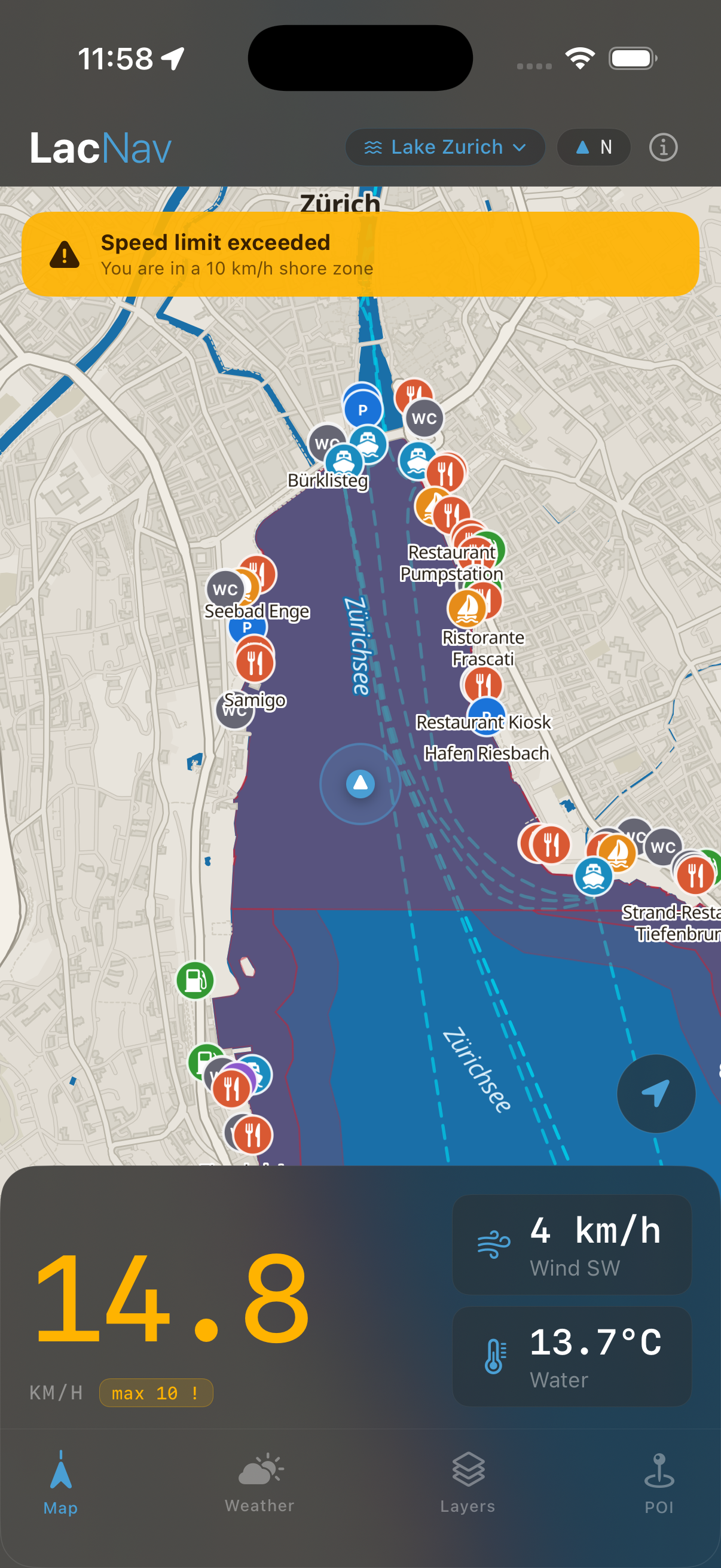
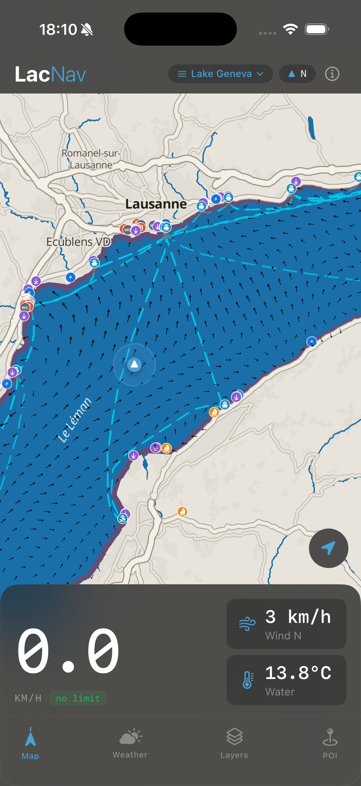
LacNav map view
LacNav speed zone alert
Swiss Lake Navigation

Know every zone. Every wind. Every restriction.

The navigation app built for Swiss waters — not adapted from somewhere else.
Download on App Store
Available on iPhone and iPad
Why LacNav

Built for Swiss waters.
Not adapted from somewhere else.

Swiss-built
Most marine apps are built for oceans and adapted downward. LacNav started with Swiss lakes — the cantonal zones, the named winds, the seasonal sport restrictions, the ferry operators. Every detail comes from local knowledge, not approximation.
Always know where you stand
Swiss lakes are more regulated than they look. Speed zones are strict, Föhn conditions can change a crossing in minutes, and what's permitted on one shore isn't always permitted on the other. LacNav was built so you always know before you leave the harbour.
For every boater
Used by sailors, motorboaters, SUP riders, and day-trippers alike. Whether you know a lake by heart or you're visiting for the first time, LacNav gives you the same confidence a local takes for granted.
"Built for Swiss waters. Not adapted from somewhere else." — A Swiss boater
THE FEATURES

All the right features.
One Swiss app.

Dynamic Sport Spots New
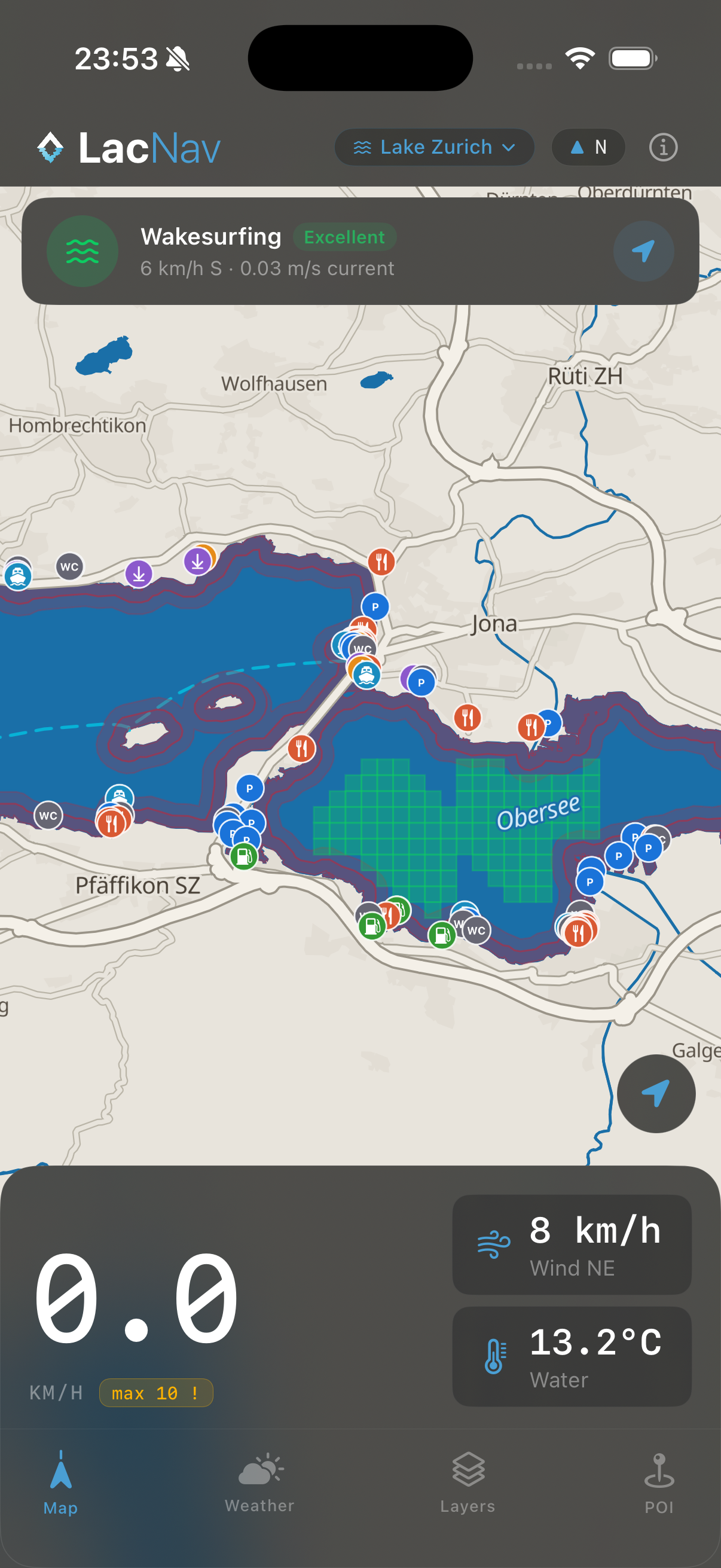
On the right day, at the right spot, everything clicks. LacNav's proprietary formula reads live wind, weather, and conditions to highlight the best watersport windows on selected lakes — so you spend less time guessing and more time on the water.
Uferzone & Speed Alert
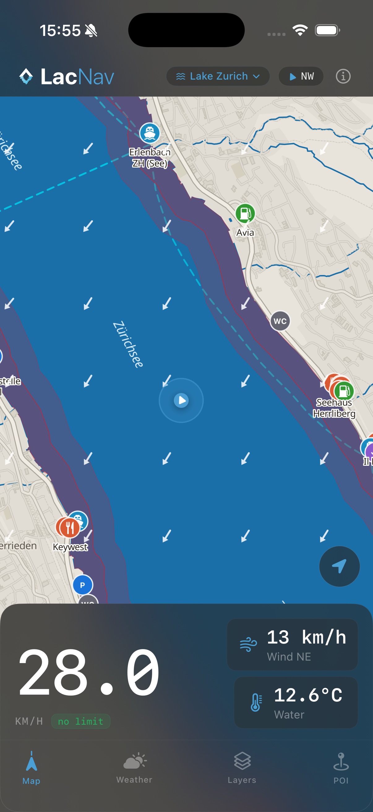
Swiss shore zones are strict — and fines aren't small. Every Uferzone is mapped and stored offline. The moment your speed exceeds the limit inside a zone, an audible alert fires. You stay legal without staring at the screen.
Weather at a Glance
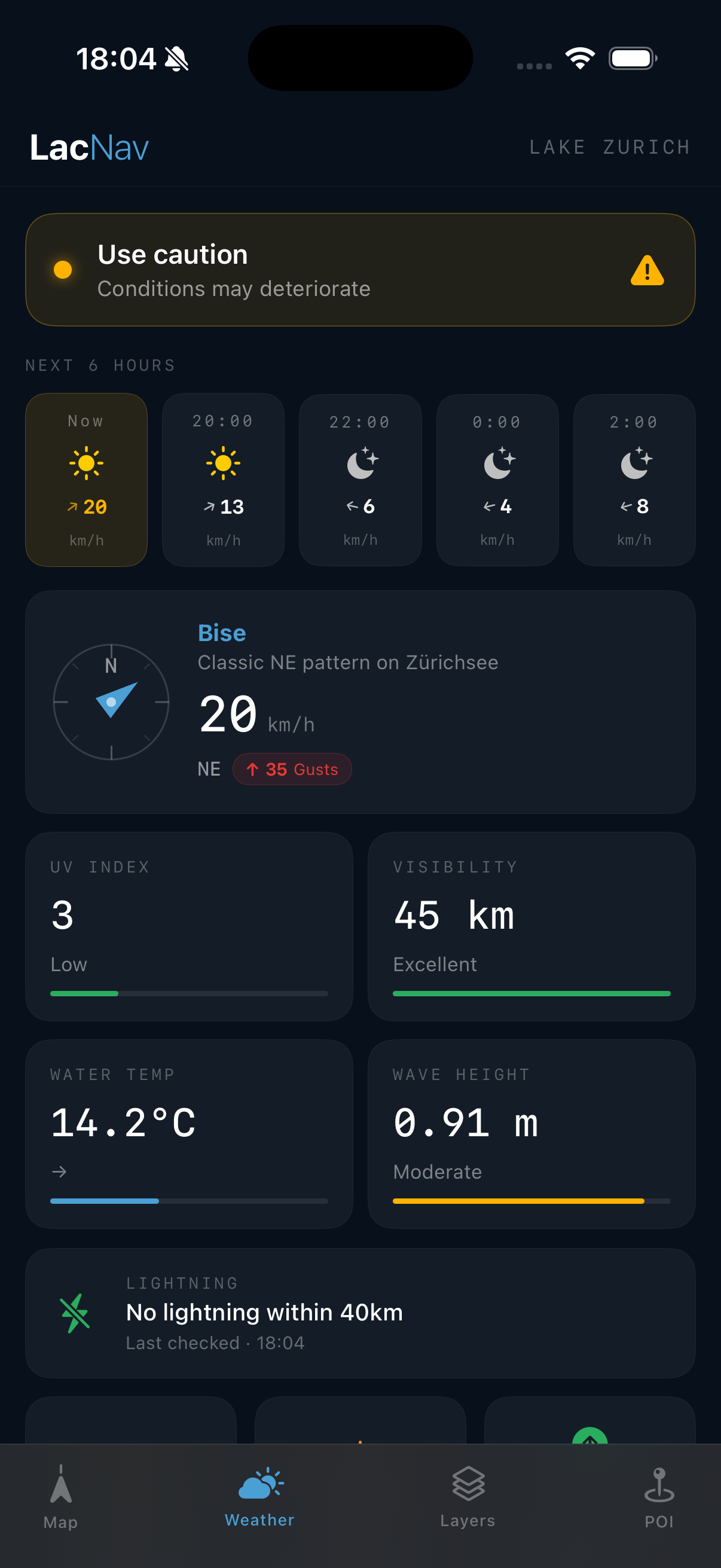
Wind strength and direction. Water temperature. Wave height. UV index. A 6-hour forecast. Thunderstorm warnings. It's everything the lake tells an experienced skipper — now in one screen, available to everyone.
Weather & Overlays
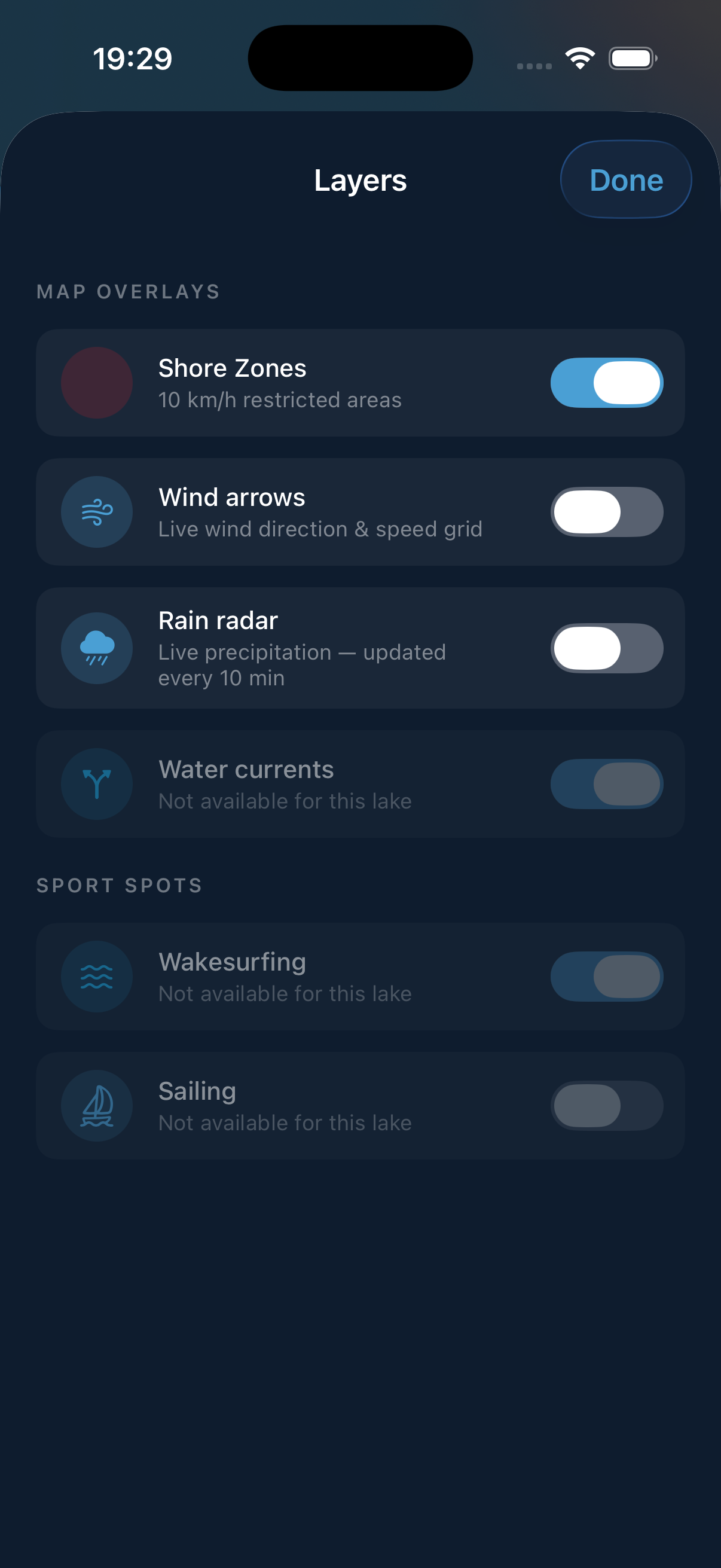
Wind, current, and live rain radar — layered directly onto your chart. See where the Bise is pushing or the Föhn funnelling before you commit to a route. Thunderstorm cells move fast — a 10-minute radar refresh gives you time to reach harbour.
POI & Favourites
Fuel running low? Looking for a lakeside lunch spot? Every marina, fuel station, and restaurant across every lake is a tap away, with direct navigation. Mark favourites or drop your own custom POI anywhere on the map.
Works Without Signal
Once you've downloaded your lake, LacNav doesn't need a signal. Charts, zones, POI, weather cache — all there, whether you're in a marina with full bars or mid-lake with none.
Feature screenshot
In action

See what's
on screen.

LacNav navigation view
Navigation
Sport zones
Sport Spots
Speed zone alert
Zone Alerts
Weather overlay
Weather
Overlays
Overlays
Offline navigation
Offline Navigation
Lake coverage

10 Lakes. 1 App.

From the Zürichsee at your doorstep to the Italian flair of Lago Maggiore — all 10 major Swiss lakes, covered in full detail. One purchase unlocks them all.
Zürichsee
40 km · 88 km²
The home lake. The Föhn turns glassy water into steep chop fast, and the Uferzone corridor is among the most enforced in Switzerland. ZSG ferry lines, every speed zone from Rapperswil to Bürkliplatz, and Föhn buildup alerts — all offline.
Lac Léman
73 km · 580 km²
Switzerland's sea. The Bise, the Vent du Lac, and the Séchard each behave differently — and the cantonal zones differ between Vaud and Geneva. Named wind alerts, live current overlay, and 200+ POI from Yvoire to Chillon.
Bodensee
63 km · 536 km²
Three countries, one chart. Swiss, German, and Austrian zones mapped together, BSB ferry routes included. Föhn recognition tuned to Konstanz conditions — because what's legal on one shore isn't always legal on the other.
Vierwaldstättersee
38 km · 114 km²
Four arms, four personalities. The Föhn accelerates differently through each one — from the exposed Urner See to the sheltered Küssnachter Arm. SGV paddle steamer routes mapped, with Föhn intensity calibrated arm by arm.
Thunersee
18 km · 48 km²
Alpine intensity in a compact lake. Föhn bursts off the Niesen and Stockhorn arrive fast, and active sport zones shift by season. BLS ferry lines and every zone — including the marked channel into Thun harbour.
Brienzersee
14 km · 30 km²
The quiet one — and the most turquoise. Glacier-fed, cold, and more exposed to valley Föhn than it looks. Fewer boats, all zones covered, BLS connection to Brienz mapped.
Lago Maggiore
66 km · 212 km²
Where Switzerland turns Italian. Tramontane from the north, Inverna from the valley — conditions at Locarno and Arona can differ completely. Full lake coverage, Swiss and Italian zones on one chart, Borromean Islands included.
Lago di Lugano
27 km · 49 km²
A navigator's lake. Fjord-like arms, a border through the water, and the Favonio hitting Lugano bay without much warning. Swiss and Italian zones on one chart — including Campione d'Italia.
Neuenburgersee New
38 km · 218 km²
Third-largest Swiss lake, stretching 38 km from Yverdon to Neuchâtel along the Jura. The Joran sweeps in from the north, the Vent builds from the southwest — both can turn glassy water rough fast. Full Uferzone coverage, named wind alerts, live current overlay.
Zugersee New
14 km · 38 km²
A compact mountain lake in central Switzerland. Föhn channels through from the south with little warning, and the Uferzone rings most of the shoreline. Bise and Föhn alerts, full zone detection, live current overlay — all offline.
Simple pricing

Buy it once.
Use it every summer.

One-time · No subscription · Ever
LacNav Pro
All 10 lakes · All features · Forever
CHF 50
less than one tank of fuel · one purchase · lifetime updates
All 10 lakes — Zürichsee, Léman, Neuenburgersee + more
Live GPS with Uferzone speed limit detection
Full weather — wind, UV, water temp, wave height, lightning
Named wind alerts — Bise, Föhn, Séchard, Tramontane
Rain radar · Ferry routes · POI overlays
Offline maps — works without mobile signal
Sport spots — find the best wakesurf & sail conditions on selected lakes
DE · FR · IT · EN — four languages supported
Available on iPhone and iPad